 Breaking News
Breaking News
Google Maps to Display 'Gulf of America' Name Change as Trump's Order Takes Effect
By The Daily Ledger2 min read51 views
Google has outlined how it will display the Trump administration's renaming of the Gulf of Mexico on its Maps platform, affecting how millions of users see the…
Google Reveals How Gulf of America Name Will Appear on Its Maps
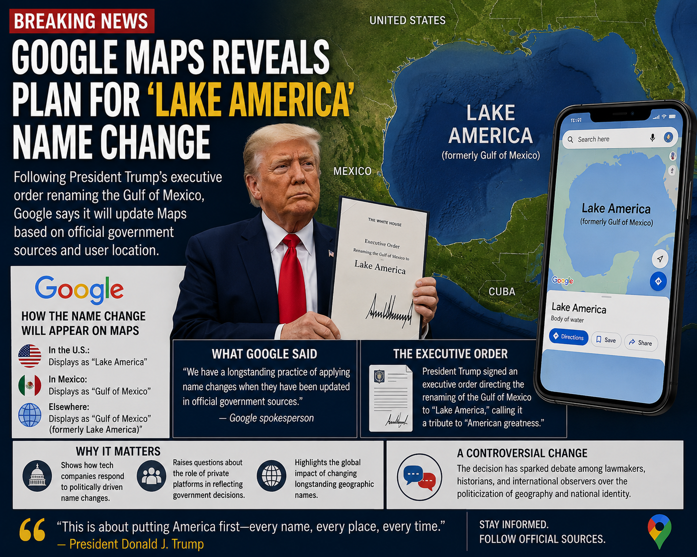
Google has detailed how it plans to display the Trump administration's renaming of the Gulf of Mexico on its Maps platform, providing users with their first clear picture of how the politically directed change will look in practice.
The update follows an executive order signed by President Donald Trump directing federal agencies to adopt the name Gulf of America for the body of water that borders the southern United States, Mexico, and Cuba. As part of that order, the U.S. Board on Geographic Names — the federal body responsible for standardizing place names across government agencies — was instructed to update its official records.
Google has historically aligned its Maps platform with designations from the U.S. Board on Geographic Names for locations within the United States. Once the board updates its database to reflect the new name, Google indicated it would follow suit on its platform. The company has suggested the change will be visible to users in the United States, while users in Mexico may continue to see the traditional name, and users in other countries could see both names displayed together or the internationally recognized original.
The approach reflects a balancing act that major tech platforms increasingly face when governments issue directives that conflict with internationally recognized geographic standards. The Gulf of Mexico has carried its name for centuries and remains the name used by the governments of Mexico and Cuba, as well as by international bodies and most global maps.
Mexico's government has previously pushed back against the renaming, asserting that the body of water carries a name with deep historical and cultural roots that no single country can unilaterally change. The United Nations and other international cartographic organizations have not adopted the new designation.
For Google, the decision carries significant reach. Google Maps is among the most widely used navigation and mapping tools in the world, meaning any name change it implements will be seen by an enormous number of people across different countries and contexts. The company has faced similar questions before when governments have disputed territorial boundaries or place names, and its general policy has been to show different views depending on the user's location.
The renaming has drawn both support and criticism within the United States. Supporters see it as a straightforward exercise of presidential authority to shape how American institutions refer to the nation's surrounding geography. Critics, including some geographers and historians, argue that renaming a body of water recognized internationally for generations is largely symbolic and risks creating confusion in scientific, commercial, and diplomatic contexts where consistent geographic terminology matters.
Other mapping services are expected to face similar decisions about whether and how quickly to adopt the new designation as the federal database update is finalized.
#Climate
Related Stories
Breaking News

Comments (0)
No comments yet. Be the first to share your thoughts.
Leave a comment
Comments are reviewed before they appear.